CÍES ISLAND
HIKING ROUTES CIES ISLANDS
Monte do Faro Trail, Alto do Príncipe Trail, Faro da Porta Trail and Monteagudo Trail.
Maybe when you arrive at the beach and feel the fine white sand at your feet, what you feel like doing is lying down in the sun and enjoying the microclimate of this environment, but if you’re a nature and outdoor lover you will undoubtedly enjoy the hiking routes in the Cíes Islands. The long walking paths surrounded by unique flora that run through the northern island are an adventure for any traveller who will be accompanied by some native animals such as the yellow legged gulls present in every corner, as they are the largest colony of this species in the world.
In order to discover the natural beauty of the Cíes Islands, it is necessary to visit every corner of them. There are several signposted walking paths corresponding to the 4 routes of the Cíes Islands. The route of the Cíes Lighthouse, with a fantastic view of the Rhodes beach, the route of Alto do Príncipe, with spectacular cliffs, the route of Faro da Porta, which allows us to observe the island of San Martiño and the route of Faro do Peito which allows us to discover wooded areas, an old settlement and an ornithological observatory.
All of them, suitable for both beginners and experts, make hiking in the Cíes Islands one of the essential activities ideal for those curious tourists. Although they are not long routes, it is advisable to do them without rushing to observe every detail of the path or to take a break.
Visiting Cíes means enjoying paradise, and once there you can either choose to bask in the sun on the white sand or explore every corner of the island. If you prefer the latter option, just follow one of the routes of the Cíes Islands and you will be able to discover wooded areas, old settlements and breathtaking views.
![]()
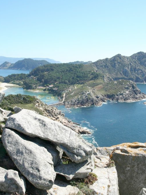
» Monte do Faro Trail
![]()
After passing the A Nosa Señora Beach, you will begin the zigzag climb towards the lighthouse. Among the thick grove, you can see, to the south, the beautiful San Martiño island. Next, as you ascend, you will find the curious Pedra da Campá, pierced by the force of the Atlantic winds, and the bird observatory, from which you can enjoy stunning views of Lago dos Nenos and from the Rodas Beach. Finally, you reach the lighthouse, which is the most emblematic viewpoint of the Cíes Islands, with views of the three islands, the cliffs, and the beaches.
LENGTH:
7.4km (round trip)
DURATION:
2h 30min (round trip)
DIFFICULTY:
Medium
TYPE:
round trip
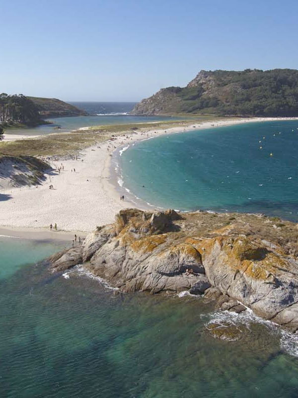
In its first few meters, the Alto do Príncipe Trail allows you to enjoy a fantastic view of the Rodas Beach and surrounds the Dunar de Figueiras – Muxieiro Complex, where a representation of the typical species of these fragile ecosystems is located. The path continues ascending near the Figueiras Beach, and continues winding the path until, after a short descent, it opens up to discover part of the spectacular landscape of cliffs and beaches. From Alto do Príncipe you can enjoy privileged views of this area of the island. The spectacular panoramic views from this point allow us to appreciate the contrast between the two slopes of the island: the softer east face and the much more abrupt west face. The final section of the route runs along a path between rocks shaped by the wind and water until you reach the Silla de la Reina, a whimsical rock formation resulting from the tremendous erosive action that constitutes one of the most beautiful viewpoints on the islands.
![]()
» Alto do Príncipe Trail
![]()
LENGTH:
3km (round trip)
DURATION:
1h 15min (round trip)
DIFFICULTY:
Low
TYPE:
round trip
![]()
» Faro da Porta Trail
![]()
This route runs along the southern coast of Faro Island and offers unbeatable views of the South Island. It is a 5.2 kilometer route of low difficulty, at which the traveler can visit, among others, O Castro das Hortas.
LENGTH
5.2km (round trip)
DURATION:
1h 45min (round trip)
DIFFICULTY:
Low
TYPE:
round trip
The O Monteagudo Trail stands out for offering spectacular views of the estuary from the Faro do Peito. From this point, you can see the Ons archipelago, Cabo Home, O Monte Facho and Costa da Vela. Along its 5.6 kilometers you can also see the remains of the Old Cuncheiro, the Figueiras Beach, the Bird Observatory, the Faro do Peito or the Furna de Monteagudo.
Next, it approaches the foot of Alto de Monteagudo, whose characteristic shape gives its name to this island. At this point the path leads, through a small wooded area where the ruins of an old island settlement were found, to the Bird Observatory. From here you can already see the Faro do Peito. To get to this point you will have to descend a little along the path. This area of the Cíes Islands is the closest to the continent and from it you can see the Ons archipelago to the north, at the entrance to the Bay of Pontevedra, Cabo Home, or Monte Facho de Donón and Costa da Vela
![]()
» O Monteagudo Trail
![]()
LENGTH:
5.6km (round trip)
DURATION:
1h 45min (round trip)
DIFFICULTY:
Low
TYPE:
round trip
DO NOT WAIT ANYMORE…
BOOK YOUR TICKET NOW
The ticket to your dream destination
IMPORTANT ANNOUNCEMENT
IF YOU ARE GOING TO TRAVEL TO THE CÍES ISLANDS OR THE ONS ISLAND FROM EASTER AND MAY 15 (EXCEPT CAMPERS), before buying the ticket, you must obtain the authorization requested by La Xunta de Galicia, in which they will provide you with the pre code -reserve (necessary to acquire the boat ticket).
YOU CAN ALSO ENJOY ...

BEACHES
Discover incredible beaches with Mar de Ons.
RODAS BEACH
The best beach in the world

NATURE
Enjoy nature in all its splendor.

EXPERIENCES
Discover unforgettable experiences with Mar de Ons.
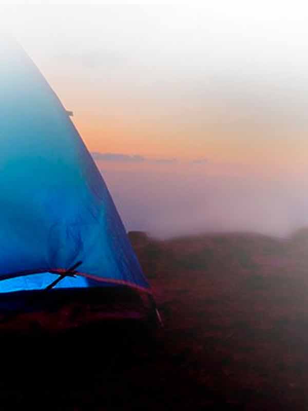
CAMPING
Sleep in the Cíes Islands and enjoy the incredible sunsets.

HIKING TRAILS
Get lost in the most amazing corners

HISTORY CÍES ISLANDS
Discover the history of the Cíes Islands.

TRAVEL GUIDE
Discover everything you need to know to prepare your trip

PHOTO GALLERY
Get to know Cíes Island before arriving.