
Hiking trails in Rías Baixas: nature in its purest form
Discovering Rías Baixas through its trails means entering a universe of lush nature and captivating landscapes. In this post, we show you some of the most popular trails, so you can enjoy a good walk while admiring the beautiful landscapes of our territory.
Trail along the coast of A Guarda
The coastal path of A Guarda invites you to explore the coastline from the town’s port to the mouth of the River Miño, culminating in the charming beach of O Muíño.
Along its 5.6 kilometres, this walking route, also suitable for bicycles in the first half of the path, gives you the opportunity to stroll along the coast with the Atlantic Ocean in the background. Along the way, you will find several viewpoints from which to soak up this breathtaking area.
Molinos do Folón e do Picón O Rosal route
The Molinos do Folón e do Picón route is located in El Rosal, a municipality in the south of Pontevedra on the banks of the River Miño. As you can imagine, the scenery on this route is spectacular.
Along the way, you’ll have the opportunity to see a series of 60 watermills dating back to the 17th and 18th centuries. In 1998, they were officially recognised as Assets of Cultural Interest (BIC) and are considered a priceless heritage gem.
These mills are distributed across two sections, each with a distinctive name:
- The series of O Folón mills includes 36 structures located on the hillside of O Folón, along which the stream known as Folón flows.
- The series of O Picó mills includes 24 structures located on the slopes of the Picón River.
It’s a simple 3.5-kilometre route that combines nature and heritage along a stunning route that allows you to discover an unknown area of Pontevedra.
Mount A Guía route
This 6 km route runs along the coastal side of Mount A Guía, in . It’s a circular path that begins on the coast and climbs up the mountain to about 128 metres. Once at the top, hikers can enjoy wonderful views of the city of Vigo and its spectacular estuary.
It is a largely easy walk. It has information panels and is safe to do with children.
Donón route
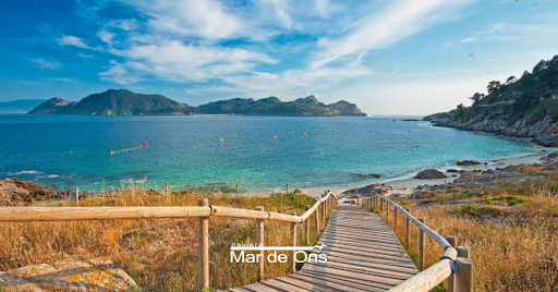
The route begins at the famous sculpture of the Caracola de Donón snail, a work of art by Lito Portela, and continues towards the set of dunes on Barra beach until you reach the lighthouse of Punta Subrido. From this point, you can admire breathtaking panoramic views of the ría de Vigo estuary, the Cíes Islands and the Island of Ons (belonging to Ria de Pontevedra).
As you walk through Punta Robaleira, you get the opportunity to visit the Cabo Home lighthouse (iconic lighthouse painted red), before reaching the Costa da Vela, where the cliffs take centre stage, offering an open view of the horizon.
Sanxenxo trail network
Sanxenxo offers an extensive network of trails that stretch over 25 kilometres. These sections connect to beaches that have the Blue Flag. So, if the weather is good, you can always stop for a swim.
The trails that make up this route are the Magic Trail of A Lanzada, the Canelas–Punta Cabicastro Trail, the Magor-Montalvo Trail, the Montalvo-Paxariñas Trail, the Sanxenxo-Portonovo Trail and the Areas-Punta Festiñanzo Trail.
If you want to get to know them all, you can choose a different path every day to discover the different facets of this area. These are simple, easy trails that are in very good condition in a spectacular setting overlooking the coast.
Bao-Xastelas Trail
This trail runs along the coast of the Island of Arousa (A Illa de Arousa, in Galician). This coastal route crosses the southeast area of the island and connects the beautiful beach of O Bao with the O Carreirón Natural Park.
As you go along the trail, you will come across various beaches of different shapes and sizes, but they all look stunning. Along the route, you can also see several ecosystems, including magnificent marshes and rock formations.
This trail is very simple, well signposted and also suitable for families.
‘Entre Faros’ trail on the Cíes Islands
The Cíes Islands are located at the entrance to the ría de Vigo estuary and form part of the Atlantic Islands National Park.
It’s a large natural area made up of Faro Island, Monteagudo Island and San Martiño Island, and has several routes that lead to beautiful trails through which you will discover every corner of the islands.
The ‘Entre faros’ (literally meaning ‘between lighthouses’) route is one of them. This route consists of two existing routes, Faro do Peito and Faro de Cíes, offering the option of undertaking a walk that will give you great views of the charming two islands
This route departs from the Information Centre, which is located near the port (close to Rodas Beach). From there, you can head north on a 5km trail marked with a red sign. Along the way, you can see different sights on the island such as the Dunar de Muxieiro-Figueiras Complex, the bird observatory, Figueiras beach and Peito Lighthouse.
After this route, you can head towards the southern trail, which starts from the Information Center, is 7 km long and has yellow signs. Along the way, you can admire the spectacular Rodas beach and its dunes, as well as Lake dos Nenos and the impressive Cíes Lighthouse.
As you can see, Rías Baixas is surrounded by natural landscapes that you can explore through various trails. Make a note of these routes, so you can make the most of your experience. In addition, if you decide to take the trail, keep in mind that offers a special transport service from the ports of Vigo and Cangas throughout the year.
