HIKING ROUTES
Old Town Route, Cogorza Trail, Cabo Home Trail, Las Furnas Trail, Areamilla to Limens Coastal Trail, Vigo in 60 minutes, Monte do Castro Trail, Old Town Route Vigo, Vigo Panoramic Trail…
» Old Town Route – Cangas
![]()
One of the curiosities of Cangas is ‘O Reloxo’, an old meteorological forecasting equipment built at the beginning of the century, which is consulted by fishermen before beginning their voyages at sea.
From the Alameda, the route continues to Plaza del Arco, the old gate to the town. From there, a walk through the streets of Antonio Garelly and its skate houses will transport you to the Middle Ages, through these typical fishing houses of the Rías Baixas.
Next, the Rúa Real, with its emblazoned houses combined with beautiful buildings from the end of the 19th century that show off their white galleries and their coats of arms, shows us the most important monument in the town: the former collegiate church of Santiago de Cangas.
The Church of Cangas was built in the 16th century and raised to the rank of Collegiate Church in 1542. From an architectural point of view, this temple combines Gothic and Renaissance elements. From the late Gothic period is its basilica plan with three naves covered with star vaults, as well as the buttresses and pinnacles on the outside.
At the end of the 16th century, the sculptor Mateo López erected the Plateresque-style façade, one of the most beautiful in Galicia. In it, two bodies are distinguished where the four evangelists are represented. Above them, a triangular pediment in which the figure of Christ is found.
Inside the temple, the altarpiece of the main chapel stands out, where there is an image of the Christ of Comfort by the master Juan Pintos and a silver cross of great artistic value.
From here, and through the Rúa do Hío, you will reach the Barrio Eirado do Costal, the primary nucleus from which the town grew.
If you go up the Síngulis Street, where there is an old coat of arms of the Inquisition, you will arrive at the square of the same name, wich has a beautiful baroque cross.
The last stage of this route through Cangas do Morrazo is the Barrio de Señal, a small maritime borough where you can visit beautiful gardens and the Hospital Chapel, built in the 18th century and currently restored.
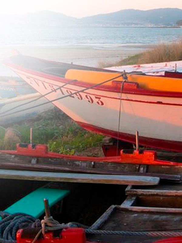
From there, a promenade begins that reaches Rodeira Beach, the main sandy area of the town.
LENGHT:
DURATION:
DIFFICULTY:
TYPE:
round trip
The path continues along the promenade, past the fishing port and the marina.
Along this path you will arrive at the Factoría Conservera Massó, an old canning factory and one of the most innovative from the 1950s. Despite being in ruins, you can still distinguish the old whaling ramps and the facilities they had for their workers: nurseries, dining areas and showers.
Then, passing through Punta Balea, you will arrive at the Lago de la Congorza or Laguna Massó, also known as the “Laguna de los Patos”, a place of great natural wealth and an ideal area to enjoy unique moments of recreation.
» Congorza – Cangas Trail
![]()
LENGHT:
DURATION:
DIFFICULTY:
TYPE:
round trip
» Cabo Home – Cangas Trail
![]()
The tour starts from the port of Cangas and leads directly to the Massó complex, a set of buildings that are currently in ruins and that marked an important economic and business evolution for the Cangas population. Next, there is a small grove that leads us to the ruins of the old whaling ship.
Leaving behind the whaling buildings, you can admire the small Laguna da Corgonza, a place of great scenic beauty that safeguards a great diversity of species.
The route continues to Furnas and continues through an area of spectacular cliffs overlooking the Cíes Islands and recently discovered archaeological sites, to the area of the beaches of Liméns, Nerga, Viñó and Barra.
The path goes up a slight climb in which the remains of an old salting factory are found, until reaching Cabo Home, where the lighthouses of Sobrido, Rodeira and Cabo Home, witnesses to shipwrecks, adventures, and great historical events that took place there.
Cabo Home is a coastal area, open to the Atlantic Ocean, which is protected by the Cíes and has an important complex of dunes. It is a protected natural space, within the Red Natura 2000, together with Cabo Udra and O Facho.
LENGHT:
DURATION:
DIFFICULTY:
TYPE:
The route starts from the port of Cangas and runs through the old canned Massó and the whaling ship, key buildings in the economic evolution of Cangas and that left their mark on its history.
The route continues through a tunnel that leads to an area of cliffs, more than 150 meters above the sea, with particular rock formations called “furnas”, caves created by the erosion of the sea on the coast.
The route ends at this point, from where there are impressive views towards the sea.
» Las Furnas – Cangas Coastal Trail
![]()
LENGHT:
DURATION:
DIFFICULTY:
TYPE:
round trip
» Areamilla to Liméns Coastal Trail – Cangas
![]()
Next, there is another of the hidden corners of Cangas do Morrazo, the Laguna de Massó, a natural lake that is home to a wide variety of birds and has become a wonderful resting area.
Laguna de Massó is a unique area in O Morrazo, since there are practically no similar habitats in the region. Up to seven species of ducks live here, among which is the duck, which breeds and lives all year. It also breeds the redfish and, in winter, the coot appears. The white heron, the gray heron and the kingfisher rest and sleep in the trees that border the lagoon.
The last part of the route is the most beautiful and least known and runs along a path towards the Liméns Beach.
This path also passes through the Furnas, which are holes created by the sea that excavates from below and reach the top of the road.
The route ends by visiting Areamilla Beach, which is in a small inlet and has a Blue Flag; and Liméns Beach, a very popular beach in Liméns Cove and which also has a Blue Flag and a large number of services.
LENGHT:
DURATION:
DIFFICULTY:
TYPE:
round trip
Following the route through Calle Príncipe until the end, we arrived at Puerta del Sol, so called because it was one of the seven entrances to the old walled town. Right here is El Sireno, a sculpture by the Galician Francisco Leiro, which represents the union of the people of Vigo with the sea, through a hybrid between man and fish.
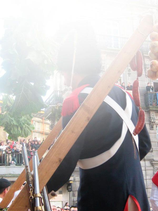
In front, crossing the street, is the Plaza de la Princesa, where the Angelote stands, a monument that commemorates the Reconquest of Vigo, when in 1809 he expelled the Napoleonic troops, becoming the first Spanish city to revolt against the invader.
In this area is the historic district, a unique place with great charm, full of places where you can taste rich and varied tapas, washed down with a wonderful local wine. From the Plaza de la Princesa, the route continues to the Plaza de la Constitución, where the old town hall is, today the headquarters of the Casa Galega da Cultura. In this square you can see the arcades of the 19th century buildings that the artisans used to sell their products. Right there is the first electric light that was lit in the city.
The route continues on the left side of the square, where it passes through Rúa dos Cesteiros and through Plaza de Almeida, where the Casa de Ceta is located, the oldest in the historical area and today the headquarters of the Camôes Institute of Language Portuguese.
To the right of this square is the Collegiate Church of Santa María, which houses the image of the Christ of Victory, to whom the triumph over the French troops is popularly attributed. Just below is the Plaza de A Pedra, where the route ends and where you can taste the famous oysters from the estuary.
» Vigo in 60 minutes
![]()
LENGHT:
DURATION:
DIFFICULTY:
TYPE:
round trip
» Monte de O Castro – Vigo Trail
![]()
Going down the roads that border the O Castro fortification in the direction of the historic neighborhood, you will come to a viewpoint where the Rande Galleon Monument is located: three anchors and several cannons found at the bottom of the estuary.
The route continues to the left, where you can find the archaeological remains of the first inhabitants of Vigo: circular stone houses from a castreño town from the 2nd century BC, which give its name to the mountain.
Finally, going back a little, descending towards the historic center, is the Town Hall tower. Just behind him are the remains of the San Sebastián fortress, the other great defense of the city, along with the O Castro fortification.
LENGHT:
DURATION:
DIFFICULTY:
TYPE:
round trip
Going up Calle Colón you reach Calle de Policarpo Sanz, where the most significant buildings of the golden mile of Vigo architecture are found, such as the García Barbón Theater or the headquarters of several banks.
Continuing along this street, the route ends at the Puerta del Sol, where the Sireno stands, a sculpture half man, half fish that symbolizes the symbiosis of Vigo with the sea. Here begins the pedestrian and commercial Calle Príncipe, at the end of which is the Museum of Contemporary Art.
Returning to Puerta del Sol, we cross into the historic neighborhood through Plaza de la Constitución, where the old town hall is located. From this arcaded square several streets depart with craft shops and typical gastronomic products.
The route through the streets of the old town towards the sea, passes through the Collegiate Church of Santa María, the main church of the city and ends at an air walkway that crosses to the A Laxe Shopping Center, in the Trasatlánticos Dock, an area of excellent Galician gastronomy in which seafood and wines with Rías Baixas designation of origin stand out.
» Old Town Route – Vigo
![]()
LENGHT:
DURATION:
DIFFICULTY:
TYPE:
round trip
» Vigo Panoramic Trail
![]()
LENGHT:
DURATION:
DIFFICULTY:
TYPE:
round trip
Once the tour along the river is finished, you can continue along the Blue Path, whose layout includes the walk along the river and continues along the beaches of Vigo. Through this route, you can see picturesque sandy areas, framed in a natural enclave of great beauty.
» Track Azul – Vigo
![]()
LENGHT:
DURATION:
DIFFICULTY:
TYPE:
round trip
» Route of Agua – Vigo
![]()
Along this route you will come into contact with beautiful and varied natural species, and it is an ideal leisure activity to go with children, since it has no slopes and is a simple route.
LENGHT:
DURATION:
DIFFICULTY:
TYPE:
round trip
DO NOT WAIT MORE…
BOOK NOW YOUR TICKET
The ticket to your dream destination
IMPORTANT ANNOUNCEMENT
IF YOU ARE GOING TO TRAVEL TO THE CÍES ISLANDS OR THE ONS ISLAND FROM EASTER AND MAY 15 (EXCEPT CAMPERS), before buying the ticket, you must obtain the authorization requested by La Xunta de Galicia, in which they will provide you with the pre code -reserve (necessary to acquire the boat ticket).
You can also enjoy ...
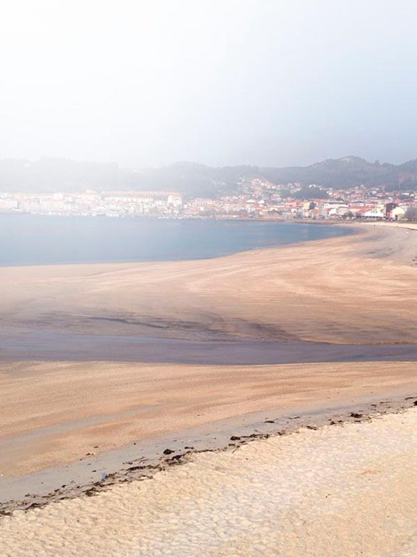
BEACHES
Discover incredible beaches with Mar de Ons

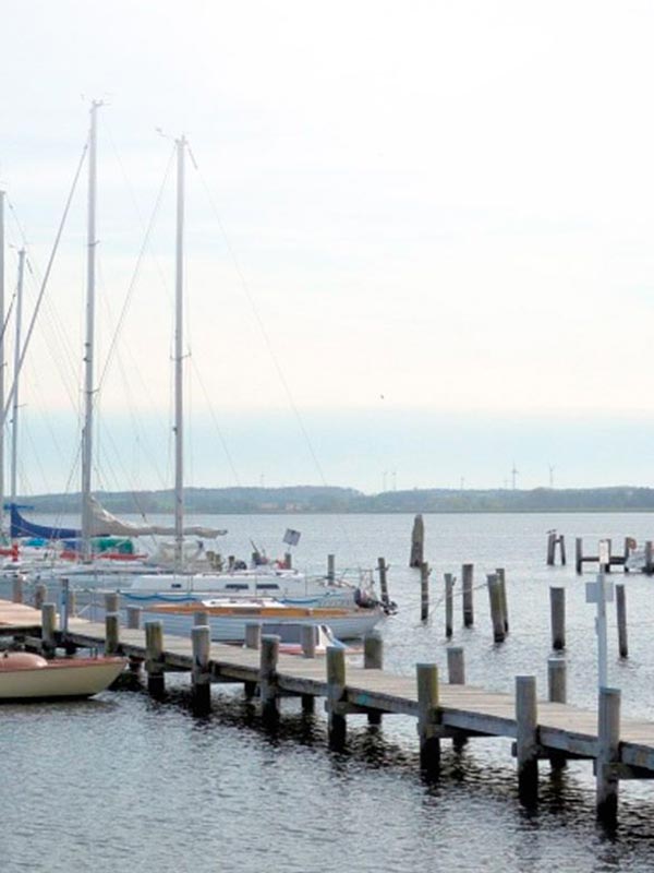
HIKING TRAILS
Get lost in the most amazing corners

EXPERIENCES
Discover unforgettable experiences with Mar de Ons
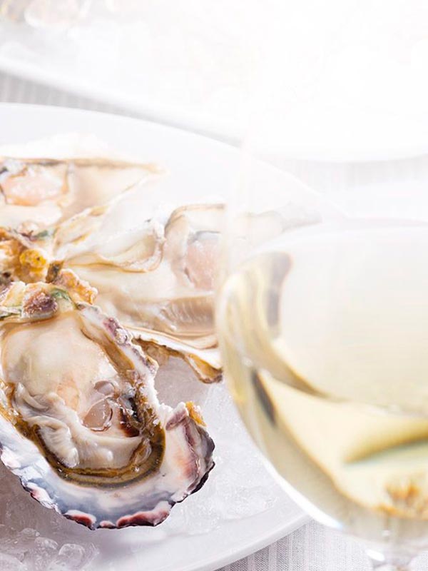
GASTRONOMY
Enjoy exquisite food
VIGO-CANGAS HISTORY
Discover the history of Vigo - Cangas

NATURE
Enjoy nature in all its splendor.
PARTIES
Discover the most important festivals of Vigo and Cangas