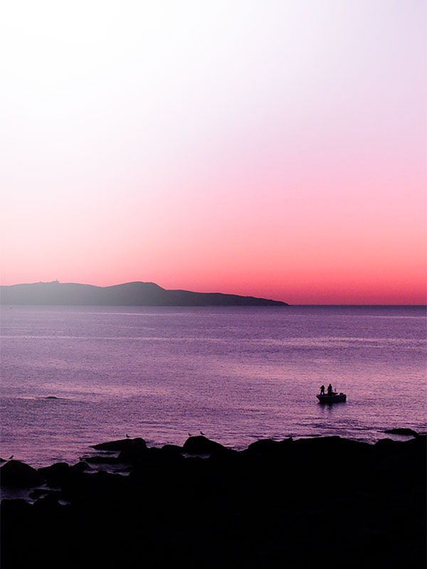
HIKING ROUTES
South Trail, Noth Trail, Faro Trail and Castelo Trail.
» South Trail
![]()
In its first section, parallel to the beaches of the southeast coast: after the first one, Area dos Cans, you can see the group of rocks where O Laxe do Crego is located, an anthropomorphic sarcophagus dated to the Middle Ages and since then an object from multiple legends. A little further on, the Canexol Beach and its fragile dune complex appear, currently in the process of recovery. In front of it, on the other side of the road, the old rectory with its traditional granaries, the school, the nearby cemetery and the old church are part of the history of man on the islands. The houses along the way, some of them still inhabited today, formed the neighborhoods of Canexol and Pereiró.
The path will take us, in about 45 minutes from the beginning of the route, to the beautiful viewpoint of Fedorentos, from where it offers us the best views of the nearby Onza islet and the entrance to the Bay of Pontevedra, with the majestic Cíes archipelago. Going back a little to the west, there is the Buraco do Inferno, where the continuous attacks of the ocean have built this curious geological formation, a hole of more than 30 meters that communicates with the sea, producing an unforgettable hoarse sound, between the vertical cliffs that make up this area of the island. From here we continue skirting the west coast until we reach Ensenada de Caniveliñas.
LENGHT:
DURATION:
DIFFICULTY:
TYPE:
round trip
The path continues up north, until it reaches the highest point of the itinerary: the crossroads where the track that comes from the lighthouse meet.
Up to here it takes about 40 ‘approximately. The path continues northwards between gorse, heather and broom, with the immense Atlantic Ocean as a continuous scenic background. If visibility allows, from here you can see the Sálvora Island, with Ribeira in the background, the entrance to the Bay of Arousa and the tip of the O Grove peninsula. The path, now descending, continues to undulate until it reaches a junction where if we turn left it will leave us, in about fifteen minutes, at the Punta Centolo viewpoint. After two hours of journey, this spectacular balcony, located in the extreme north of the Ons Island, will allow us to enjoy one of the most beautiful and complete views of the coast: Sálvora, now very close to the Riviera coast and the cut-off mountain range of the Barbanza; behind the peninsula of O Grove, A Lanzada, the Bay of Pontevedra, the small Bay of Aldán, Costa da Vela, Onza and the Cíes Islands as a backdrop.
The importance of this place, in addition to being landscaped, lies in the fact that it is one of the breeding areas for the shag cormorant and the yellow-legged gull, the two most abundant and representative species of seabirds in the National Park. For this reason, access to the viewpoint is restricted from February 15 to July 31, the nesting season for these birds. Contrary to the always boisterous seagulls, which will play with the wind next to us, to observe the elusive shaggy cormorants we must look at the most remote rocks and islets, where they gather to dry their black plumage in the sun. We will pass through Punta Liñeiros and Punta Xubenco, until we reach the Melide Beach, the most beautiful sandy area of Ons. Years ago, Melide was the place chosen by many visitors to spend long periods on the island; from this time, only the nudist tradition of the beach survives, since currently camping is only allowed in the area established for it, in the place of Chan da Pólvora. Next to the descent to the beach, to the south of it, begins the path that, skirting the east coast of Ons, will take us to the starting point. At first, among eucalyptus trees, which are gradually giving way to native vegetation, such as some young horses, laurels and even a specimen of Cytisus insularis, a broom for now only described in Ons and Sálvora, which we can observe along the way, next to a small elderberry. When the scrub becomes predominant, it will be interesting to look back to see Alto de Centulo and Melide, with the sandy bar of A Lanzada in the background. Soon, arriving at the Cucorno neighborhood and after the willow-covered slope, you can see part of the lighthouse lantern.
» North Trail
![]()
LENGHT:
DURATION:
DIFFICULTY:
TYPE:
round trip
» Faro Trail
![]()
Later, after the factory closed in the early 20th century, the Riobó family, who owned the island at the time, settled there. Once at the main crossroads, after crossing the town, the route continues along the paved track that begins by gently ascending towards the southwest. About 200m to the right we can see one of the country houses that best shows the architecture of the area: rectangular floor plan, ground floor, doors and windows facing east, barn, granary and a space to store the dorna, traditional fishing boat , dry.
Before taking the next turn, the splendid views of the Bay of Pontevedra will make us stop for a while. It meanders now between ancient farmland. A little later, a few scattered houses warn us that we have reached the Cucorno neighborhood. In the background, the large hexagonal tower of the Ons Lighthouse is cut out.
Currently, it is not possible, unless expressly authorized, to access the Lighthouse site, so we will turn off, 100 m before it, along a track that leads to the west of the island on our left. In a few minutes we will be next to the detour that accesses the small heliport and which is worth approaching, since this is where the magnificent lighthouse building is best viewed. Located at the highest point of the island, at 119m above sea level, it raises its lantern to 128m; along with that of Sálvora, it is one of the few remaining in Spain still attended by lighthouse keepers. Uninterruptedly since 1926, the year in which it began to operate, first with oil and nowadays through a system of solar panels, its powerful beam of light guides the numerous maritime routes that cross the Rías Baixas.
After imagining the hard but interesting life of a lighthouse keeper, we will retrace our steps to resume the previous track, which ends at the one that borders the entire west coast. We will head south (to our left), following the path that descends through the thick thicket of gorse, heather and rockrose that begin to lose ground in the face of the harsh conditions imposed by the Atlantic Ocean, which we can see in the trimmed modeled cliffs by the force of the water.
The Ensenada de Caniveliñas, which gradually fills our field of vision, is the deep inlet that determines the narrowest area of the island, about 350m wide.
LENGHT:
DURATION:
DIFFICULTY:
TYPE:
round trip
We cross a small trough in which the native riverbank woodland, such as willows, indicates the presence of fresh water, which in these islands, unlike Cíes, is abundant. A little further on, looking to the left at the height of a small clearing, we will see the lantern of the Ons Lighthouse appear, at 128m above sea level. The path, which now winds through a corridor of hawthorns, sloes, rockrose, gorse and ferns on a fluffy carpet of clovers and silenes, will take us to the Mirador do Castelo (15 minutes from the pier), an old defensive fortification, nowadays in ruins, and that we will find to the right of the clearing in which the path ends.
This magnificent watchtower offers us beautiful views of the entire eastern coast of the Ons Island and the Bay of Pontevedra. Towards the North, in the foreground, we see Melide Beach, the most beautiful and emblematic sandy area of the Ons Island. To the South, the pier, Curro, the Canexol Beach, the small Onza Island and in the background, almost always between mists, the Cíes archipelago.
Following the coastline, the trimmed profile of Costa da Vela, the small Bay of Aldán, Bueu, the inside of the Bay of Pontevedra and to the north, the spectacular A Lanzada Beach, stand out.
» Castelo Trail
![]()
LENGHT:
DURATION:
DIFFICULTY:
TYPE:
round trip
DO NOT WAIT MORE…
BOOK NOW YOUR TICKET
The ticket to your dream destination
IMPORTANT ANNOUNCEMENT
IF YOU ARE GOING TO TRAVEL TO THE CÍES ISLANDS OR THE ONS ISLAND FROM EASTER AND MAY 15 (EXCEPT CAMPERS), before buying the ticket, you must obtain the authorization requested by La Xunta de Galicia, in which they will provide you with the pre code -reserve (necessary to acquire the boat ticket).
YOU CAN ALSO ENJOY …

BEACHES
Discover incredible beaches with Mar de Ons

NATURE
Enjoy nature in all its splendor

EXPERIENCES
Discover unforgettable experiences with Mar de Ons

HIKING TRAILS
Get lost in the most amazing corners

ONS ISLAND HISTORY
Discover the history of the Island of Ons

TRAVELER'S GUIDE
Discover everything you need to know to prepare your trip